Powerful Analytical Tools to Ensure Safety In Our Skies
the risks
URSA’s Airspace Awareness Platform + NMAC (AAP-NMAC)
URSA’s Airspace Awareness Platform + NMAC (AAP-NMAC) was developed to support FAA research into unmanned UAV activity in the low altitude National Airspace. Led by Associate Professor Ryan Wallace of Embry-Riddle Aeronautical University, the ASSURE A50 project used AAP-NMAC to produce the first of three annual reports for the FAA on this topic. [1]
AAP-NMAC uses what is commonly known as counter UAS (CUAS) data as the primary source for UAV behavior and metadata. URSA’s vendor and source agnostic ability to unlock valuable insights from often expensive CUAS data is unique in the industry and puts us on the leading edge of efforts to focus on broader airspace awareness issues.
[1] Wallace, R.J., Terwilliger, B.A., Winter, S.R., Rice, S., Kiernan, K.M., Burgess, S.S., Anderson, C.L., De Abreau, A., Arboleda, G., & Gomez, L. (2022). Small Unmanned Aircraft Systems (sUAS) Traffic Analysis: Initial Annual Report [Grant No. A11L.UAS.91]. Alliance for System Safety Through Research Excellence (ASSURE), Federal Aviation Administration.
the platform
URSA’s Airspace Awareness Platform (AAP)
The ever-increasing number of Unmanned Autonomous Vehicles (UAV) within the national airspace creates a significant and growing risk to public safety. URSA’s Airspace Awareness Platform now gives everyone the critical insights needed to monitor UAV activity and create safety and security – both on the ground and in the sky.
If you have access to CUAS data that is sitting idle, please reach out and let us unlock insights from it that likely support more stakeholders than initially imagined.

UAV Behavior Insights for Everyone
URSA’s Airspace Awareness Platform (AAP) now provides everyone with easily accessible, objective insight into the who, what, where, when, why, and how of drone behavior.
Initially used exclusively by the FAA, URSA’s AAP is now available to regulators, investigators, journalists, and manned aircraft operators.
Analyze UAV Traffic Patterns, Trends, and Safety Risks
Via URSA’s intuitive self-service platform, URSA consulting, and integration with numerous other platforms, users can now access a wide array of insights regarding UAV activity and behavior.
AAP turns terabytes of raw data – from a variety of sources – into intuitive visualizations and provides the data needed for comprehensive analysis of traffic, trends, regulatory compliance, and safety risks.
Answer Critical Safety Questions Quickly and Easily
- Number of sUAS operating within and outside of Part 107 rules
- sUAS traffic evolution over time
- sUAS flight patterns and altitudes
- Estimated registration rates for sUAS
- Percentage of detected traffic not required to register with FAA and other regulatory bodies
- Actual and forecasted economic potential of drone tracks by location, across the NAS, and over time
- Continual improvements to safety and efficiency in UTM
- Traffic risks associated with sUAS operations
The ability to answer these questions, and many more, is now available to anyone via a self-service platform, consulting relationships, or via integration into other platforms.
URSA NMAC Analytics
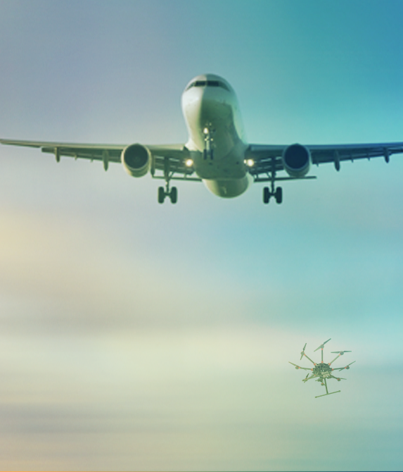
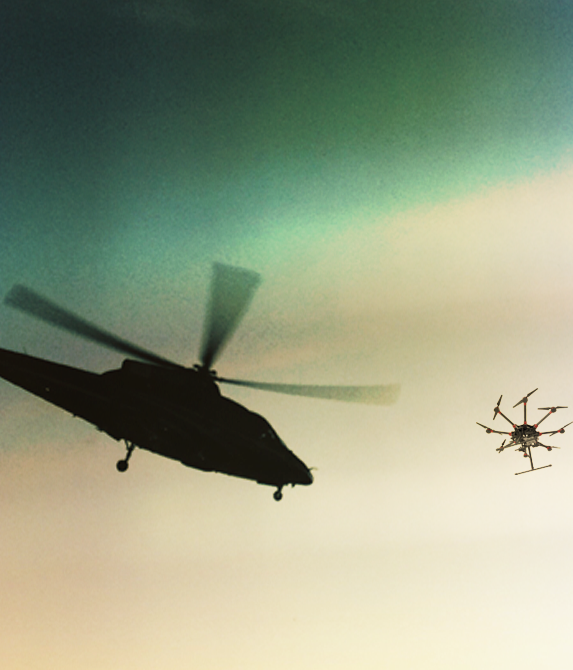
Needed Insights To Prevent UAV Near Mid Air Collisions (NMAC)

What is the likelihood that a pilot will encounter a near mid air collision (NMAC) with an unmanned autonomous vehicle (UAV)?
NMACs may be the greatest risk UAVs pose to public safety.
URSA’s NMAC analytics provides the insights needed to understand and prevent UAV NMACs. URSA’s NMAC analytics replaces subjective analysis with the objective data and visualizations needed to assess, understand, and act on problematic and unlawful UAV behavior.
Replace Subjective Assessments of Near Midair Collisions
URSA’s NMAC replaces subjective assessments of near midair collisions with objective data and reporting.
Currently pilots, while in flight, visually identify and evade conflicting sUAS and then report estimates of range, altitude, and other associated flight information – with few to no tools for measurement or examination.
URSA’s NMAC provides comprehensive, court-admissible, NMAC data sets, graphic representations, and analytical capabilities – all designed to ensure safety in the sky and on the ground.
Analyze Terabytes of Airspace Data – From Multiple Sources
Vendor agnostic, AAP-NMAC fuses UAV track data with manned aircraft track data to clearly identify and categorize close approaches and near midair collisions.
Identify and Classify sUAS-aircraft Encounters and Trends:
- Areas of encounter risk
- Lateral and vertical encounter separation distances
- sUAS operator compliance with operational and altitude restrictions
Land use, weather, time of day, and various GIS layers relating to critical infrastructure enable comprehensive incident analysis.
Address Issues, Share Analysis, Take Decisive Action, Include the Public
URSA’s NMAC analytics provides objective data, visualizations, and output that simplify the analysis and communication needed for decisions, action, and public conversation.
URSA NMAC:
- Map the location of all events
- Share location files (.CSV) regarding all involved aircraft with identifying characteristics
- Analyze facts associated with the incident in brief paragraph form
URSA simplifies the analysis and reporting process by providing key information that enables the rapid, accurate production of objective summaries.
The design specification for the platform, including very detailed explanations of all of the reports, is now available.
Example Incidents
Analysts access data and information within NMAC to quickly generate reports similar to:

During the month of August 2021 there were five near mid-air collision (NMAC) events
All five incidents had less than 1,000 feet of horizontal separation and two were within 500 feet horizontally

Three incidents involved commercial flights and two separate incidents involved the same Part 135 helicopter
Four of the five incidents occurred over public park

The UAV was in excess of 300 feet above the helicopter in one incident
what others are saying about us
Testimonials

CHIEF CHARLES WERNER, DIRECTOR AT DRONERESPONDERS AND 46 YEAR PUBLIC SAFETY VETERAN
URSA provides the analytics that feeds an evidentiary chain that enables administrators to address issues. This information is absolutely necessary for safety in the national airspace and also for the protection of critical infrastructure.
DR. RYAN WALLACE, EMBRY-RIDDLE AERONAUTICAL UNIVERSITY
URSA provided a streamlined method of combining and analyzing multiple types of data from a variety of sources, enabling us to better understand potential safety implications of sUAS operations in low-altitude airspace.
CHIEF CHARLES WERNER, DIRECTOR AT DRONERESPONDERS AND 46 YEAR PUBLIC SAFETY VETERAN
URSA’s work is groundbreaking.
DR. RYAN WALLACE, EMBRY-RIDDLE AERONAUTICAL UNIVERSITY
URSA allows us to break down problems individually and look at each component rather than just relying on evaluating data independently – we can see how it all interacts together.
Powered By
Our Data Providers

OpenSky Network: Provider of ADS-B manned aircraft data
The OpenSky Network is a non-profit association based in Switzerland. It aims at improving the security, reliability and efficiency of the air space usage by providing open access of real-world air traffic control data to the public. The OpenSky Network consists of a multitude of sensors connected to the Internet by volunteers, industrial supporters, and academic/governmental organizations.
To learn more visit: OpenSky Network.org

Spire: Provider of AIS commercial shipping data
Spire Global, Inc. (NYSE: SPIR) is a leading global provider of space-based data, analytics, and space services, offering access to unique datasets and powerful insights about Earth from Space so that organizations can make decisions with confidence, accuracy, and speed. Spire uses one of the world’s largest multi-purpose satellite constellations to source hard to acquire data and enriches it for the maritime, aviation, and weather industries.
To learn more visit: spire.com

AirGuard: Provider of UAV / drone data
Airguard is a leading airspace security software for drone detection. The AirGuard platform arms your team with real-time airspace security against rogue drones providing visibility and integration with existing security systems. AirGuard is a layered open platform software that integrates with electronic drone-detection technologies like radio Frequency (RF) sensors, Directional finding sensors, and 3rd party specialty drone Radars and cameras in order to provide your team with the most comprehensive and advanced airspace security.
To learn more visit: www.Airsight.com
Download the Report
Assure Small Unmanned Aircraft System (sUAS) Traffic Analysis (A11L.UAS.91): Initial Annual Report
